Saturday, March 26, 2011

PANAMA, Casco Veijo

What was once the heart of Panama City and its most affluent neighborhood, Casco Veijo looks appealing from the top of Ancon Hill. Our two visits to the neighborhood revealed that it is, indeed, an area in transition. The guidebook cautions that Casco Veijo can be dangerous, especially at night, the instances of muggings at gunpoint are much more rare than the threat from pickpockets and bag snatchers. Both of our guides, one a professional tour guide and one a common cab driver, assured us that the area is safe especially during the day and mostly safe at night due to the heavy presence of military looking policemen stationed everywhere to guard against something bad happening to the president, whose residence is here.

Our drive through and walking in the area were mainly confined to the part of the district shown at the right side of the first photo. The main streets run about diagonally to the photo from top
left to bottom right. The area we walked is at the extreme top right of the photo. You can see the sea wall which forms a sort of sideways V with the v of the V pointing to the right. Inside of the sea wall you can see a tall, thin column. It is the focal point of the Plaza de Francia (French Square) which commemorates the 22,000 or so workers who died during the French attempt to dig the canal. There is a big bronze rooster on top of the column. I didn't know that the French used a chicken as their national symbol, so sometimes you learn something you didn't expect just by looking up. Also within the Plaza, there is a statue of Carlos J. Finlay, who is credited with producing the research that lead to the eradication of Yellow Fever.

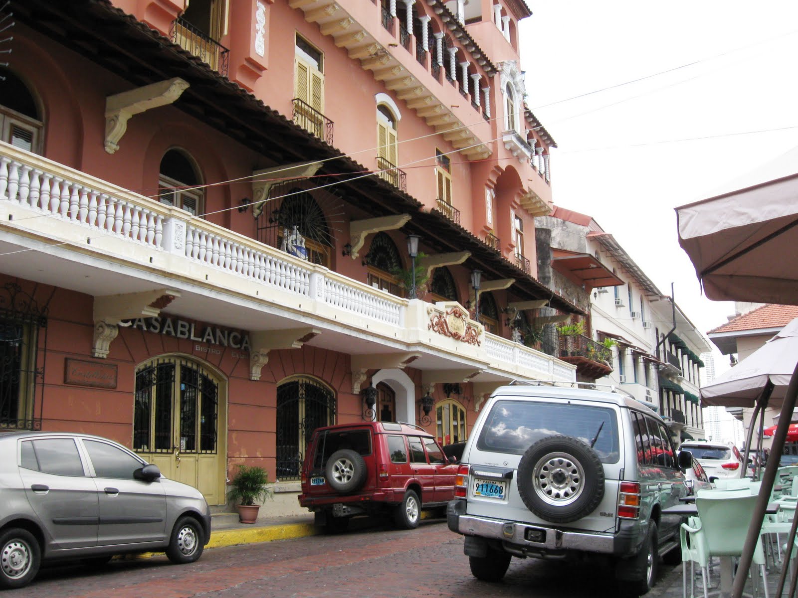
But before you get to the chicken column and the sea wall, you have to pass through some of the less than pretty parts of Casco Veijo. I didn't get a really good look at this building, but it appeared to be still occupied. The right side of the second floor wall bulges out about two feet at its base, and even though the balcony has been shored up by the angle braces, you might not want to be under it when it was being used. There are several additional photographs on the Facebook extras of buildings in the area that are in desperate need of removal or restoration.

Many buildings have been restored, including the Vaults, which are also inside the sea wall, just to the left of the column and the statue. The Vaults were built in the 16th or 17th century. It wasn't clear to me if they were there when Henry Morgan and his fellow pirates ransacked and burned in 1671. They were used as safe storage where Spanish ships could leave material and whatever for later use by other Spanish ships or troops. I think there are six of them side by side. Three of them are now used as a very appealing restaurant.
We didn't eat there but we did get a tour by the man in the photograph, who I think is the owner. When we arrived he was strolling in the courtyard and he engaged me in conversation as I was admiring the welded artwork you can see in the photo. (There are closeups of each of the three pieces in the extras. There are also interior photos of the restaurant in the extras that show what each vault looked like.) You can see the right side of the Vaults in the first photograph just to the left of ther rooster column.

The sea wall is the business address for several, or many (we saw about 15) street vendors. Some of them are stationed on the open part of the wall and were found busily working on their crafts while they were sheltered from the afternoon sun by sitting underneath their tables. Others are spread out along this long and very appealing arbor way. It is rapidly being covered by vegetation and may not be needed in the near future for anything except to give the trimmers a guideline. This is the first place I experienced a local person refusing to be photographed without being paid.

The woman with the camera wasn't very happy and pressed the issue until the vendor had to resort to rudeness. In the end, there was no payment and no photograph. (There is a photograph in the extras of what I called a back yard, that was visible through an opening in this arbor, to the left about half way along. I got it at no charge.)

There are many restored buildings in Casco Veijo similar to this one. Some of them are government offices and some of them are private. Apparently this district is on its way to being
restored or rebuilt to its former glory.

There are many visitor attractions in Casco Veijo that we didn't see. There are dungeons, I presume from Spanish times but maybe not. The French Embassy is here. There are parks and churches and museums and a lot more waterfront. You could easily spend a day or two exploring around this small area without running out of things to see. If it does get fully restored, it will probably also get rid of many of the people who now call it home.

JCE

Wednesday, March 23, 2011

PANAMA CANAL, Gatun Locks Visitor's Center

The best photographs from the Canal Transit were from inside the top and middle locks at Gatun. You could look over the lock gates and see down to the Caribbean Sea which gives a real sense of how high you are and how you really do go up and down to get across Panama.


These photos are from the Gatun Locks visitor's center which is also on the east side of the Canal. There is a bridge that crosses the Canal here somewhere but I didn't see it. We arrived at about exactly the right time. There were two ships in the locks and four ships arriving from Gatun Lake. Everything was traveling north, toward the Atlantic. In the first photo you can see two bulkers and behind them a container ship and farther back, a car carrier. I tried to go down to the lower visitor's level which would have allowed for a better photograph. A big policeman stopped me. Workmen were sweeping, or something. The ships in the next photos are ones that were in the locks when we arrived.

The bulker in this photo will give you a really good idea of just how much clearance there is between the Panamax
ships and the sides of the locks. The distance is actually two feet or so but it looks like inches. And when you have a 1,000' long ship that's about 105 feet wide and 80 feet or so tall, the two feet really looks small. If you look over the bow of this ship you can see the container ship ahead, entering the last lock. The bulker here is entering the middle lock.

No matter how spectacular these things look, when you get right down to it, they're just mechanical structures and they need greased on a regular basis. This worker went out onto the top of the doors with his grease gun and gave everything a little shot while the water was being let out of the top lock.

The next photo is of the container ship that is ahead of the bulker. It fills the west side lock about as full as it can get and it isn't even fully loaded. The water ahead is the Caribbean Sea (actually Lego Limon) and it is about 55 feet lower than the ship is now. Unlike on the Pacific side of the Canal, there are only minimal tide shifts on the Atlantic side. The tides are as much as 20 feet between high and low tide on the Pacific side.
You can get an even better perspective from the next photo which shows both ships and Lego Limon. The container ship is entering the last lock and the bulker is in the middle lock. Both of the locks are filled to their maximum height.
The Extras on Facebook show several more photographs of these two ships plus even more great stuff. I think this is about the last photo of Panama Canal Locks that I will post. You are probably already wondering how you can get along without more and you might have to re-visit some of the earlier postings.
At any rate, you now know more about the Panama Canal than nearly anyone else I know. There are several more postings to follow that show the old City (Casco Viejo), some countryside scenery, some buildings and sights in Panama City, and maybe even more. Stay tuned.
JCE

Friday, March 18, 2011

PANAMA, Portobelo

Portobelo is a small town with a population of either "less than 3,000" or 7,964, depending on which authority you use. It appears to be a sleepy little town with no downtown, really no commercial district at all except for the dusty parking lot we used which is adjacent to a church and an open building that housed street vendors. (There is apparently a town center of commercial businesses somewhere. I have recently read a little about it but we didn't see it.)

The place was discovered by Christopher Columbus in 1502 and by the late 1500's it was the center of Spain's Caribbean operations. Between about 1570 and 1700, over a billion pesos worth of silver, gold, and other stuff was shipped from San Felipe de Portobelo to Spain, mainly Seville. For much of that time, Spain hauled trade goods to Portobelo and large gatherings were held at Portobelo (called Fairs) where gold and silver from as far away as Lima, Peru were traded for whatever was available from Spain. "Treasures" from the Orient were landed at Panama City and carried to Portobelo for further shipment to Spain.

Sir Francis Drake died at Portobelo in 1596 and is said to be buried in a lead coffin just a short distance off shore near Drake Island. The pirate Henry Morgan and his men trudged clear across Panama to sack Portobelo, and other bad guys were able to overcome the fortifications so that the ruins we see today are the result of several rebuildings, the last in about 1750. As you will see in the extra photos, there is restoration work besides clearing out the mud going on even now.

But even before we got to the parking lot, we passed the first Spanish fort to be seen from the road. It, at first, looked like a real ruin. At second glance, you could easily tell that it had been inundated by mud and stuff from upslope.
Once we realized that there had been a recent severe storm and mud slide, it was clear that we had also seen storm damage as we entered the town. The extra photos on Facebook show how, what must have been fast moving water had scoured around buildings and taken away much of the soil and whatever vegetation might have been adjacent to the buildings.

There were several people working to clear the debris from the fort, and from another view, you could tell that it was a pretty impressive example of what must have been a substantial fortress.

Within another quarter of a mile or so, we parked and walked a short block to what is left of San Jeronimo Fort and Battery. Just a few feet away from the entrance to the fort there were these real dugout canoe type boats, looking to be in good repair and just waiting for their owners to arrive to go fishing.

The next photograph looks back towards the entrance to the fort from well within the grounds. the large stone building is the customs house, built in 1630 and rebuilt at least two times, once from damage from an earthquake. It is now being restored again. I presume that the canons have been moved into place at their firing stations but it looks like they might have been there for 3 or 400 years and that their wood carriages finally disintegrated and they settled where they are seen. There are 18 canons in a row along this wall and there are six more behind me in the radiused out place you can see in the next photo.

This photo is looking back on the 18 canons and toward the six more. I haven't been able to find anything that gives an idea of what the structure over the canons might have looked like, or if there was a structure. If you look at the upper right corner, you can see the opposite side of the fort, just beyond the blue tarp where four restorers were either working or resting, I couldn't tell which. That wall has rifle ports every few feet looking behind the bay. There is a photo or two of that wall section also with the extras.

The next photograph shows the deck behind the radiused portion of the fort where the six canon positions are located. The round masonry structure in the middle is, I think, the remains of a water well. Behind the camera there is an opening in the deck that must have had at least one staircase that lead down to handsomely made vaults that housed the magazine or something else that needed extra protection. They are now used as the latrine by locals and visitors alike. (Photos in the extras)
Portobelo is considered a world historical site by UNESCO. there are other forts along the bay and there are also fortifications above the town. Today, the area is known for its scuba diving interest. The water is apparently not as clear as other Caribbean waters but there are at least 16 major dive sites nearby, including ships and at least one airplane.
JCE


Monday, March 14, 2011

CANAL TRANSIT, Part 9, Gatun Locks to the Atlantic

The Gatun Locks, at the Caribbean Sea (Atlantic Ocean) side of the Canal are at the head of a bay called Lago Limon (Lake Limon) which isn't really a lake at all but an ocean bay that has had a very long breakwater constructed across its mouth. The bay mouth is about five miles wide and the breakwater has an opening of about a half mile at roughly its center. It is about six miles from the breakwater to the Gatun Locks.
In the first photo, if you look in the very far distance you can see the tops of the container facility cranes that are located just beyond Colon, but inside the breakwater. Our little boat is entering the west side lock as its doors are opening in front of us. The long pier between the east and west locks is on the right. Beginning here at 84 feet elevation, we will go to sea level in three stages, in a distance of about 3,ooo feet, about 28 feet at each stage. It will take about 40 minutes.

The next two photos are, I think, the two best examples of what it's like to go through the locks. The first photo is with our boat still at the 84' level inside the top lock at its north (Ocean) end.

The water hasn't yet begun to go out of the lock. In the next photograph, we're in the middle lock at its north end. Even if you look back at the Pacific end when you're in the Miraflores Locks you don't get this great visual of how high you are relative to where you are going to be (or have been.)

There are many more photographs of going through the Gatun Locks in the album of extras on Facebook for this portion of the transit. If you go through them rapidly, you can get a better idea of what it's like than by viewing the few I am allowed here.
Finally, there are seemingly just as many ships waiting on the Atlantic side as on the Pacific side. These ships are all inside the breakwater. I thought I had several photos of the breakwater showing many ships on both sides and showing one very large "Post Panamax" container ship of the size that will go through the new locks. If I have them, they are hiding. (Edit: It turns out that if you enlarge the photo to full screen size you can see the breakwater. It doesn't rise veery far above the water line but it is there, in the distance.)


The last photograph of the Canal transit is of a portion of one of the two container terminals on the Atlantic side at Colon. Colon was built by some Americans at about the same time as the first railroad was built, in the 1850's. It is said that Colon is laid out exactly as is Philadelphia, with sixteen numbered streets and whatever number of cross streets with names. In 1886, while the French were digging and Colon was peopled mostly by workers imported from the West Indies, it was described thusly by James Froude, a British journalist, "In all the world there is not, perhaps, now concentrated in a single spot so much swindling and villainy, so much foul disease, such a hideous dung-heap of moral and physical abomination." Apparently not much has changed. A 2009 guide book says, "Visitors should exercise extreme caution when visiting the city of Colon. A baggage laden tourist makes an obvious target in this poverty-stricken community and Panamanians from other provinces make little secret of giving it a wide birth. Those arriving by car should lock all doors when driving through the city centre." We didn't see any of beautiful downtown Colon, only its outskirts. Apparently its 150,000 or so residents find enough other victims to keep themselves alive without prowling the part we visited.

We were told that one of the container facilities in Colon is owned by Evergreen, a South Korean company and the other by Maersk, I think a Danish company. I don't know which one this is. I'm surprised this photo is as bright as it is. We were under overcast skies and it was about dusk when we arrived in Colon. I purposely didn't try to take a photograph of a modern sailing cruise ship (Club Med 2) that was docked at the wharf at Colon 2000. It has five very modern looking masts and is apparently able to sail or motor or both. Colon 2000 is a new cruise ship dock and facility built to get tourists to the Colon Free Trade Zone and to house trinket shops on the Atlantic side of the Canal, perhaps so cruise ships could stop at Colon and let passengers off without them getting mugged. More about the Free Trade Zone and Colon 2000 later.
From here, at about 7:30 pm, we boarded a bus, one just like the one we boarded at 6:30 am in Panama City, and were driven back to our hotel. The entire ride was in the dark but, as it were, and lucky for those four (not one as I reported earlier) of you still following these posts, we re-traced about the same route by taxi during the daytime. I took about a hundred photos through the windshield and maybe I can find five to use in the posting about that trip. It will be two or three or more postings from now, after I finish with our walk along the Amador Causeway and our tour of Casco Veijo.
JCE

Saturday, March 12, 2011

CANAL TRANSIT, Part 8, Gatun lake, North End

From the last photograph in the last posting to about the far north end of Gatun Lake, there is only silty water and jungle vegetation to see and photograph. My little camera is wonderful but not good enough to show details of jungle worth reproducing here.

This first photo is of preparation for the new locks by removing most of this hill. if you expand this photo you can see many large trucks, etc. used to haul the hill away, to where no one knew. The big water tower you can see in the background is at Colon, the Atlantic Ocean city on the Canal.


The next photo is of the spillway segments on the dam that created Gatun Lake. It is constructed about a mile west of the Gatun Locks and is what made the Canal possible by flooding the central part of the passage and creating the lake. This structure is far enough away that, once again, my camera wasn't quite up to the challenge of making a good photo.


As on the Pacific side, a world class batch plant is being constructed on the Atlantic side in preparation for building the new locks. As of now, there hasn't been one yard of concrete poured for the new locks. They are to be dedicated in August 2014, about three and a half years from now. Between the plant and the camera you can see the bones of a metal building being erected. I don't know what it will be used for but workmen were placing very long pieces of corrugated roofing as we passed. I took several photos of the process to show how the roofing and the workers got onto the roof. They're in the extras that will be on Facebook after the next posting.


I think the next photo is the last one showing a dredge, this one of the track hoe variety. It's hard to get the scale but think bigger than big and you've got it pretty close.
The last photo is of the Gatun Lake entrance to the Gatun Locks. Going down from the lake to the ocean is much more visually impressive than going from the ocean to the lake.
The next posting is the last in the Canal Transit. It is also, I think, the most impressive part.
JCE

CANAL TRANSIT, Part 7, Gatun Lake, South End

Not far after leaving Gamboa, Gatun lake becomes a real lake. The ship channel is between banks that are constantly becoming farther and farther apart. The vegetation also appears to take on a more jungle like appearance with dense stands of many different types of trees and Tarzan vines just waiting to have someone swing on them. I guess they are the predecessor and inspiration for zip lines and bungee cords.
The first photo here is of the top deck of our tour boat. Except for a few of the more intrepid among us, most of the people were no longer standing and trying to catch every little new thing that went by. We had been on the boat for about six hours by this time. There was a contingent at the bow, including the folks from El Salvador, three guys who are salesmen for an Israeli chemical company, an Asian woman, a British woman and her companion, and us who were awaiting about every new sighting.

You do get accustomed to seeing big ships. I wouldn't have thought I would ever see a big ship and not want to know something about it and where it had been and where it was going. After seeing more ships than I had ever seen, it occurred to me that if you lived in Panama you could do what the British do in their train spotting hobby. Every ship has an easily visible name and most of the ships that use the canal are coming and going through it regularly. You could do the same for tug boats.

We saw many ships of the "bulker" variety, some with their own crane systems and some without. We saw many fuel transporters with foreign names but "No Smoking" in big letters across the front of the superstructure. We saw more car carriers. We saw big container ships (of the 5,000 container size, not the 18,000 container size which is what the new locks will accommodate.) I didn't get tired of seeing big ships but I did find myself wanting to see some different kind of big ship.

The island in the next photo is, I think, a corner of Isla Barro Colorado. It appears on the map to be about 1,500 acres. Even from the distance we were away from it when we passed, you could see there were many different kinds of trees all growing side by side. Our narrator told us there are more species of trees on this island than in all of Europe. It is hard to visualize how anyone could have walked around and counted the different species because it appears to be about as dense or even more dense than our coastal Douglas fir forests. Anyway, even though I couldn't find that factoid anywhere else, I couldn't find anything that would refute it either. I don't know either how many tree species there are in Europe, maybe only ten or twelve.

The last photo in this posting is looking back to the south at, about at the lowest point of vegetation, where the French spent much effort and time digging. There isn't really much to see, and certainly no one would, on their own, notice old shovel marks in the dirt. Also, the French were digging a sea level canal and we're about 84 feet above sea level on the Lake so most of the shovel marks are probably under water. One more thing about this last photo. The color and clarity of the water is about exactly reproduced here. In the last posting, the photo of the railroad bridge across the mouth of the Chagres River showed about the true color and clarity also. There doesn't appear to be algae or other growth in the water, more like just a huge load of silt.
JCE


Tuesday, March 8, 2011

CANAL TRANSIT, Part 6, Gamboa Area

The project to deepen the Canal in the Carpenter Hill area, where MINDI is working isn't as easy as starting up the pumps and sucking up the bottom. Ahead of the suction dredge and its revolving cutting head is BARU.
BARU is a Drill Boat or Drilling Barge. The site I consulted says it is either 52 meters (169 feet) or maybe 326 feet long, fifteen meters wide, its towers are 33 meters high. It has no propulsion power. It was built in 2009 specifically to perform submarine drilling and blasting on the deepening and widening project. Its job is to loosen the material on the sides and bottom so the dredges can pick it up or suck it up and remove it.

The next point of interest is behind the railroad bridge. The Chagres River is the source of the water to operate the Canal and to keep Gatun Lake full.
I couldn't easily find any volume data. This river, however, is what (along with sickness and disease) thwarted the Frenchman de Lessep's plan to dig a sea level Canal modeled after his Suez Canal. His engineers couldn't figure out how to cope with the very large volume of water carried by the Chagres during the rainy season. The working plan was that the Canal would have to be closed during these high water times. The rainy season is about eight months of the year. In the end, the French were defeated before the river itself could defeat them.
Not far north of the mouth of the Chagres River, is the town (?) of Gamboa. About all you can see of this town is what is in this photograph plus some storage yards a little farther north.
This is where the Partial Transit folks get off the boat and onto a bus for the ride back to Panama City. The entire group of transitors aboard the Islamorada got off at Gamboa because it only makes partial transits.
The Islamorada was built and christened Santana in Boston in 1912 and was a state of the art pleasure boat with a 1,000 hp gasoline fueled engine, six staterooms, fine crew quarters, and other modern conveniences. It was once owned by Al Capone. We were told it was brought to Panama by some movie star and was also owned by Steve McQueen. Those two points are not easy to verify but it is reported that it was brought to Panama in 1960. So, if you want to be added to the list of previous owners, you will probably not get an argument as long as you relinquish title sometime soon after about 1970.
Meanwhile, back to barges and dredging. The last photo here is of a clam shell bottomed barge and its tugboat tender, Gamboa. This barge, that has no name, and others just like it, are loaded by shovel front excavators or track hoes, "towed" (meaning pushed or pulled) to sea, and the clam shell doors opened to drop the load. I suppose there are permits required and specific locations designated where the material is dropped.
The new locks project calls for the channel through the Gaillard Cut to be deepened from about 43 feet to about 70 feet, and widened from whatever it is now to about 215 meters (about 700 feet) except right at Contractor Hill where the width will remain about what it is now.
When we left Gamboa, we left behind about half or more of our transitors. Those of us remaining didn't seem to include any of the wimpy folks who had spent their time in the cabin or under the sun shades for the first part of the transit. We were the hardy ones prepared to endure any hardship to go from the Pacific Ocean to the Atlantic in just a few hours.
One of the groups of transitors was an extended family partly from Los Angeles and partly from El Salvador. It consisted of a woman of about 50 and her son from Los Angeles who had flown to El Salvador where they had met her mother, her sister, her brother-in-law, and two nieces (or maybe it was her brother and sister-in-law.) They had all boarded a bus and taken a 37 hour (give or take a little) ride to Panama City. In a straight line on the map it looks like about 750 miles and you go from El Salvador to a corner of Honduras to Nicaragua to Costa Rica and finally into Panama. They had to get off the bus at each national border, show their passports and be prepared to have their baggage inspected, etc. The son, Hugo, (25, recent college graduate, unemployed, very sharp and gregarious) related that getting off the bus was really a pleasure since he got all those passport stamps, plus it was a chance to breathe. The bus bathroom was not clean and did not get cleaned during the trip. Hugo was not excited about retracing the route. They were due to go back for 37 more hours in four or five days.
JCE


CANAL TRANSIT,Part 5, Gold Hill to the End of Gaillard Cut

One of the major projects in preparation for the larger locks is to deepen the channel. Here in the Gaillard (Culebra) Cut, in order for a ship to navigate past a dredge, the dredge must move to the side. This ship (Nord Imagination) was travelling south as we were approaching the dredge, MINDI. The dredge was working in what appeared to be the center of the Canal but as we approached, you could see that it was moving its business end away from the center of the Channel, kind of pivoting sideways at its stern. Every time a ship of any size needs to pass, the dredge moves aside. In between those times, this dredge uses its 12,000 hp pumps and intake apparatus to suck up bottom material along the Cut and send it through its floating discharge pipe to the land where it is loaded and hauled away for dumping.
The floating pipe is visible on its pontoons at the edge of the water. It is about 30 inches in diameter and it makes a huge splash as the material comes out the end. The discharge is near the center of the next photo. You can compare the volume of the discharge with the size of the track hoe on the left side which is about 30' high by 40' long. There are at least four track hoes working to move the dredge material away from the discharge and load it into trucks that haul it away. MINDI has been working exclusively in the Gaillard Cut since 1942. It has been slated for replacement in May 2011 by a new, more powerful and deeper cutting dredge (being made in Holland and possibly the sister of the very large dredge in the photograph at the beginning of the Transit Posts.) MINDI will apparently be retired or sold.
This dredge has a crew of 20 and is 125 feet long. You can see the swivel apparatus right at the stern that allows the bow end to be pivoted left and right without disturbing the discharge pipe.
I didn't realize that these will be some of the last 2 or 300 thousand photographs taken of MINDI. I would have tried harder to make a better record.
We are nearing the end of the Cut and will soon arrive at Gamboa. The Partial Transit tourists get off at Gamboa and ride a bus back to Panama City. Those of us with green wristbands stay on board and complete the transit.
JCE


Monday, March 7, 2011

CANAL TRANSIT, Part 4, Pedro Miguel to Gold Hill

When you exit the lock at Pedro Miguel, you are technically in Gatun Lake, 84 feet above sea level. The feel is more of a slack water river though, because the whole thing isn't very wide. This stretch of Canal is now called the Gaillard Cut (originally it was the Culebra Cut) and it was by far the most difficult part of the Canal to dig. When you see old photographs of the digging of the Canal, it is likely they are from this area of about six miles.

The first great visual is of the Centennial Bridge (also called the Millennium Bridge), a striking suspension bridgebut with a single web of cables from each tower, rather than the double row as on the Golden Gate and most other suspension bridges. The single row attaches between the lanes of the roadway. An end view makes it look as if the bridge is almost hanging on nothing. None of the literature I have tells how long the clear span is so I will guess that it is about 1,500 feet long. The entire bridge is about 3,500 feet long.

Also in the first photo, you can see how excavations are terraced rather than sloped. Apparently sloped cuts continue to erode and can't be held in place. The terraces are like giant steps with risers and flat areas so the runoff from rain can be controlled better.

Way back when we first started the transit I showed a photo of a huge red and white crane in the lock ahead of us at Miraflores. The crane is called Titan and it has an interesting history.
Titan is about 340 feet tall. If you enlarge the photo you can see the operator's station just below the top of the first red section. I don't think there's an elevator so it is quite a hike just to get to the levers. It will lift about 350,000 pounds.

Titan and either two or three identical cranes were built by Hitler's Germany in the 1930's. Nothing I read tells what they were used for or even if the Germans ever used them. After the war, the Allies took them as war booty. One version says that one each went to America, Great Britain, France, and Russia. Another version says that there were three and one each went to America, Great Britain, and Russia. If there were four, there is no record of what happened to the one that was attributed to France. Of the three, the one that the British took capsized on the way across the English Channel and was lost. The one the Russians took has a more murky outcome, the most interesting being that they took it apart to ship it home and then couldn't figure out how to put it back together again. Anyway, those two are lost. Titan was taken to the Port of Long Beach, California. Nothing I've read tells how that was done but it must have been at least partially disassembled. It spent about fifty years in use around the Port. If you remember the Spruce Goose being in Long Beach and then being moved to Portland, you might have seen Titan lift the SG out of the harbor so it could be readied to moved to Portland. There are also some very interesting photos of Titan working on aircraft carriers, etc. Beam up Titan Port of Long Beach or Titan Panama Canal for great photos., etc. There is also a Titan in Australia but not this Titan. Anyway, about 1996 or so, the Port of Long Beach was closed as a Navy yard and Titan was either sold or given to the Panama Canal Authority. It was placed on a lowboy-like transport ship, a ship that sinks itself so its deck is deep enough under the water that things like Titan can be floated aboard and then lifted as the ship raises itself by pumping out the water used to sink it. Also, about exactly the same as a dry dock works except that the ship can haul stuff around. Titan was hauled to the Canal and is now used to lift the lock doors when that chore is needed.

Just behind Titan in the Photo above is "Contractor Hill" or "Gold Hill". The Canal between this hill on the east and the ridge on the west are not only Panama's continental divide in this area but also the single most challenging part of the canal to dig.

The digging was so hard that even now, almost 100 years later, the new locks and new dredging will not change the width of the Canal here. Rather, the channel will be deepened more vertically. The next photo is of the west side of the Canal. I failed to get a photo of both sides in one frame so you can estimate the height of the hill before the cut was done. Much of Contractor hill is now in the Pacific Ocean, having been hauled there on railroad flat cars and scraped off to make the Amador Causeway and to enlarge the islands at its ocean end.
The last photo here is of yet another car carrier in the cut off of Contractor Hill. This thousand foot long ship appears to have plenty of room to get through the cut but it's definitely one way traffic with a tugboat at the stern helping to navigate. By the way, you are looking at the bow (front) of the car carrier.

Tuesday, March 1, 2011

CANAL TRANSIT, Part 3, Miraflores Lake through Pedro Miguel Locks

As soon as you get above the Miraflores Locks you begin to really see construction on the new locks. The new locks will have three steps together on the Pacific end rather than the two at Miraflores and the one at Pedro Miguel (which are about 2.5 miles apart, not six as I reported earlier.) To connect the new locks with the lake, Gatun lake will need to be extended south to the head of the locks. To do that, the projectcalls for building an elevated canal from the head of the present Pedro Miguel Lock to the head of the new locks. The system of pilings shown in the first photograph, and which extends far up the lake, is the first step in elevating the canal. Once it is completed, it will be back filled and another set of pilings installed on the fill. When it is finished it will be back filled and another set of pilings installed on that fill. The end result will be a wall of piling upon piling upon piling behind which Gatun lake will reach the upper end of the new Pacific locks. If you are a construction buff, you couldn't find a more interesting place to visit.

For much of the way along the east side of the Canal and lake you can see the Panama railroad. It was built originally by Americans to profit from hauling gold miners across the isthmus of Panama to speed their journey to California during the 1840's gold rush. Today, as you've seen
earlier, many ships unload their cargo at the entrance to the Canal and do not transit it. The train hauls double stacked containers every day, both ways from ocean to ocean. You can also, during the week, take the train as a passenger. That trip was on our list of things to do before we left home. In the end, we had more things to do then we could get done and the train trip didn't make the cut.

Panama City isn't the only place where construction and repair is everywhere. These workmen are replacing a bumper strip on the east side of the Pedro Miguel Lock. The two guys in the water were doing the work while the four other guys work for the State of Oregon and were supervising,
and doing a fine job of it, especially the "holder of the nut", the guy sitting beside the ladder. When the worker guys needed another nut, the one on the left would wade over to the "holder of the nut" who would hand him one nut. He would wade back to his partner, they would install the nut, and he would return to "the holder." I watched that happen four times. Maybe the worker guy has a hole in his pocket. (I learned later that I had misidentified "the holder of the nut." He is actually "the supply room guy" who is responsible for all of the nuts and we should be glad he takes his job seriously.)

The Pedro Miguel Lock is uncluttered and very simple looking. The lock itself is about 1,000 feet long and 106 feet wide. The lead up piers on either end make it look long and trim, and since the excitement of going through a lock is behind everyone, it is a time to really enjoy the spectacle of this place and the simple elegance of how these locks work.


The last photo here looks back at Miraflores Lake. Our boat is now at Gatun Lake level and about to leave the lock. From the time we leave Pedro Miguel Lock until we arrive at the Gatun Locks, we will transit the Culebra Cut, now called the Gaillard Cut, and cross Gatun Lake, a distance of about 32 miles. We were told that we would regret the down time involved in this part of the transit. I will tell you in advance that I enjoyed every minute of it.
JCE